As wildfire season intensifies and extreme weather events become more frequent, the need for trusted, accurate information has never been more critical. We understand that keeping our communities safe requires more than just advanced technology—it demands strong partnerships with the people our region relies on for timely, reliable updates during emergencies.
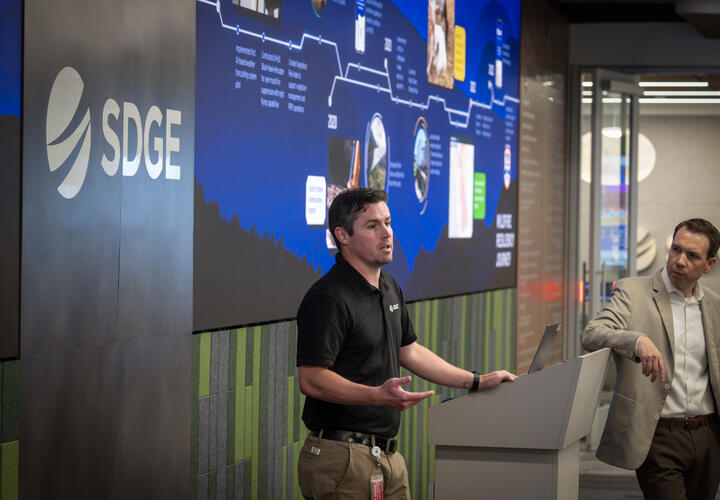
That’s why we recently welcomed meteorologists from local news outlets to our Wildfire and Climate Resilience Center for an immersive demonstration of our real-time wildfire mitigation tools and weather forecasting strategies. These tools are used to monitor weather conditions, assess wildfire risk and make informed operational decisions. The goal: to foster collaboration and build trust in the actions we take to help protect the communities where we serve, live and work.
“Media meteorologists play an essential role in shaping public awareness.”
During the event, attendees had a behind-the-scenes look at the strategic efforts of our in-house meteorologists, fire science experts and emergency operations staff. From real-time weather models to our proprietary Fire Potential Index, guests saw firsthand how science and data drive our decision-making, especially when lives and property are at stake.
"Media meteorologists play an essential role in shaping public awareness,” said Brian D’Agostino, vice president Of Wildfire and Climate Science. “Preparedness is a region-wide responsibility. When we share knowledge, we strengthen our collective ability to protect our communities. Collaboration isn’t just helpful — it’s essential.”
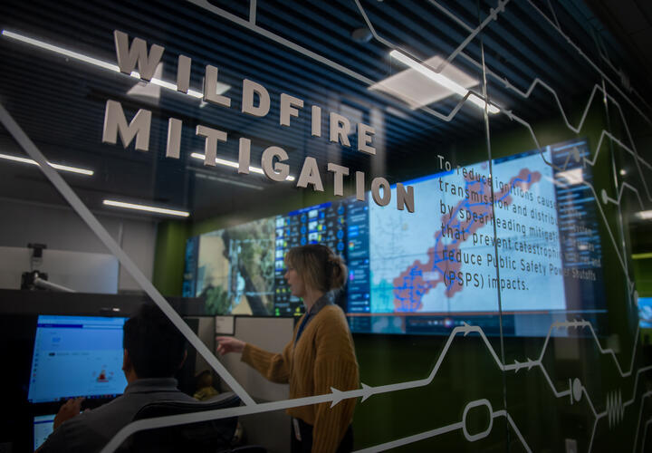
This data is critical in forecasting conditions that may lead to Public Safety Power Shutoffs (PSPS).
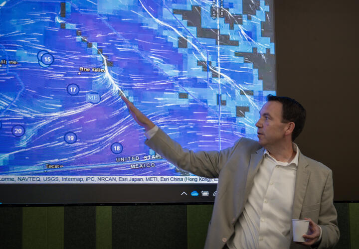
A key highlight of the demonstration was our use of hyperlocal weather data. With more than 200 weather stations across our service area, we can closely monitor wind speeds, humidity levels and fire danger in real time. This data is critical in forecasting conditions that may lead to Public Safety Power Shutoffs (PSPS) and in determining how best to prepare and respond.
Participants also learned about the extensive coordination that takes place before a PSPS event, including how we notify customers, work with first responders and deploy field crews to inspect and restore power safely and efficiently.
Image
Image
Image
Image
“As climate challenges grow, so does our commitment to innovation, collaboration and the safety of our community.”
This demonstration is just one part of our year-round outreach efforts aimed at strengthening community readiness, awareness and the trust of our community. Collaboration with local meteorologists enhances our ability to make sure the information our communities receive during extreme weather events is clear, consistent and rooted in science.
As climate challenges grow, so does our commitment to innovation and collaboration to promote the safety of our community. Together with our media partners, we’re helping San Diego County stay informed, prepared and resilient, no matter what the forecast holds.
Image
Image
The safety of our customers, employees and the communities we serve is our highest priority.
Over the past decade, we have invested nearly $6 billion in measures to prevent catastrophic wildfires. We are committed to doing more than just keeping the lights on — we are future-proofing our electric grid so that even with increasing demand and shifting weather, our communities can count on clean, safe, reliable power.
SDG&E
Number
223
Description
Weather stations throughout the region
130+
Description
Pan, tilt, zoom mountaintop cameras
~315
Description
Miles of power lines undergrounded since 2020